


045682 - WHITESBURG Voting District, Carroll County, Georgia
About
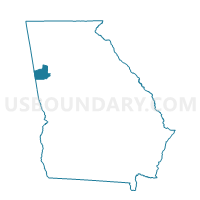
Outline

Summary
| Unique Area Identifier | 560464 |
| Name | 045682 - WHITESBURG Voting District |
| County | Carroll County |
| State | Georgia |
| Area (square miles) | 49.56 |
| Land Area (square miles) | 48.97 |
| Water Area (square miles) | 0.59 |
| % of Land Area | 98.81 |
| % of Water Area | 1.19 |
| Latitude of the Internal Point | 33.50665540 |
| Longtitude of the Internal Point | -84.90148630 |
Maps


Graphs
Select a template below for downloading or customizing gragh for 045682 - WHITESBURG Voting District, Carroll County, Georgia


Neighbors
Neighoring Voting District (by Name) Neighboring Voting District on the Map
- 0451163 - LOWELL Voting District, Carroll County, GA
- 0451483 - CLEM Voting District, Carroll County, GA
- 0451542 - HULETT Voting District, Carroll County, GA
- 07708 - CEDAR CREEK Voting District, Coweta County, GA
- 07711 - WELCOME Voting District, Coweta County, GA
- 07712 - PANTHER CREEK Voting District, Coweta County, GA
- 0971260 - FAIRPLAY M S Voting District, Douglas County, GA
- 121CH03 - CH03 Voting District, Fulton County, GA
- 121CH05 - CH05 Voting District, Fulton County, GA
Top 10 Neighboring County Subdivision (by Population) Neighboring County Subdivision on the Map
- Newnan CCD, Coweta County, GA (99,028)
- Carrollton CCD, Carroll County, GA (55,393)
- Fairplay CCD, Douglas County, GA (8,607)
- Palmetto CCD, Fulton County, GA (7,684)
- Whitesburg CCD, Carroll County, GA (3,974)
Top 10 Neighboring Place (by Population) Neighboring Place on the Map
Top 10 Neighboring Unified School District (by Population) Neighboring Unified School District on the Map
- Fulton County School District, GA (528,870)
- Douglas County School District, GA (132,403)
- Coweta County School District, GA (127,317)
- Carroll County School District, GA (86,094)
Top 10 Neighboring State Legislative District Lower Chamber (by Population) Neighboring State Legislative District Lower Chamber on the Map
- State House District 65, GA (75,570)
- State House District 70, GA (69,309)
- State House District 68, GA (65,624)
- State House District 71, GA (59,721)
- State House District 69, GA (51,692)
Top 10 Neighboring State Legislative District Upper Chamber (by Population) Neighboring State Legislative District Upper Chamber on the Map
- State Senate District 35, GA (214,483)
- State Senate District 30, GA (212,492)
- State Senate District 28, GA (191,899)
Top 10 Neighboring 111th Congressional District (by Population) Neighboring 111th Congressional District on the Map
Top 10 Neighboring Census Tract (by Population) Neighboring Census Tract on the Map
- Census Tract 9107.01, Carroll County, GA (9,171)
- Census Tract 804.02, Douglas County, GA (8,607)
- Census Tract 104, Fulton County, GA (7,684)
- Census Tract 1701, Coweta County, GA (7,162)
- Census Tract 9108, Carroll County, GA (3,974)
Top 10 Neighboring 5-Digit ZIP Code Tabulation Area (by Population) Neighboring 5-Digit ZIP Code Tabulation Area on the Map
- 30135, GA (61,912)
- 30263, GA (53,008)
- 30116, GA (23,156)
- 30268, GA (9,090)
- 30187, GA (8,740)
- 30185, GA (3,892)